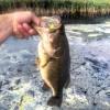
MN_Bassin Posted July 21, 2015 Posted July 21, 2015 So there's a lake near me that is my secret honey hole, it is man made (the construction company dug it out) and has no boat access, and only electric motors are allowed on the lake. In my kayak, my only competition is home owners on their pontoons (and most don't fish) or little kids off of docks. There's rumored to be potential state record LMBs in there, and I believe it, because my PB came out of there. However, there is no lake depth map available, so me and my friend have stuck to skipping docks, the weeds between docks, and a few bridges. I know a lot of big bass like to hang out deep, but we've never had much success because we are casting blindly. Is there anything that would heighten our success for bigger bass? Or do we just stick to fishing like we have been and hope for another lucky day? The average fish is probably 17" and 2+ lbs, and there is honestly millions of tiny sunfish, so the main successful pattern is a sunfish colored swimjig. What would you do? 1 Quote
Super User Senko lover Posted July 21, 2015 Super User Posted July 21, 2015 Unless you have a depth finder, it's gonna be kinda hard to break down the deeper areas of the lake. You could spend days dragging a jig, but that would test your sanity . I'd stick to the bank, you'll find some big fish eventually. Quote
Super User Wayne P. Posted July 21, 2015 Super User Posted July 21, 2015 So there's a lake near me that is my secret honey hole, it is man made (the construction company dug it out) and has no boat access, and only electric motors are allowed on the lake. In my kayak, my only competition is home owners on their pontoons (and most don't fish) or little kids off of docks. There's rumored to be potential state record LMBs in there, and I believe it, because my PB came out of there. However, there is no lake depth map available, so me and my friend have stuck to skipping docks, the weeds between docks, and a few bridges. I know a lot of big bass like to hang out deep, but we've never had much success because we are casting blindly. Is there anything that would heighten our success for bigger bass? Or do we just stick to fishing like we have been and hope for another lucky day? The average fish is probably 17" and 2+ lbs, and there is honestly millions of tiny sunfish, so the main successful pattern is a sunfish colored swimjig. What would you do? If you don't want a full fledged sonar/GPS unit. Get the Vexilar Sonarphone with Navionics App. You can collect data and create a contour map there in real time. The display would be your smartphone or tablet. Android and/or iOS I do both. You would have Sonar, GPS, and contour mapping anywhere you want. Download the Sonarphone App to your device and run the Simulator--it's FREE. 1 Quote
starcraft1 Posted July 21, 2015 Posted July 21, 2015 You said a const. co. made the lake. Why not get a hold of the company. I'm sure they'll have a map of the lake. All the projects I worked on have them, It's something they have to show on the plans. Your local city / country should have copies, 2 Quote
Super User HoosierHawgs Posted July 22, 2015 Super User Posted July 22, 2015 You could try the Deeper fishfinder. Not the greatest thing, but would at least give you a view of bottom comp and depth. Quote
Bruce424 Posted July 22, 2015 Posted July 22, 2015 Somthin I always wanted to do was to dive in the lake like the show hook and look. 2 Quote
Super User RoLo Posted July 22, 2015 Super User Posted July 22, 2015 Unless that lake was a strip mine, it's not likely that the entire terrain was excavated. In any case, I would obtain the topographical quadrangular that encompasses that lake. Unlike a hydrographic map (which everyone calls a topo map), a true topographic map illustrates the topography 'before' inundation. Roger 1 Quote
AdamsEye Posted July 22, 2015 Posted July 22, 2015 I am pretty disappointed in the navionics app, it only has like 5 lakes in NJ with contours. One of them is small shallow lake, the others are 500 acres reservoirs. The government page is free, I got the maps on my phone in pdf form, and it has far more maps then navionics. Even still I am left with lakes and no maps. http://www.njfishandwildlife.com/lakemaps.htm Quote
MN_Bassin Posted July 22, 2015 Author Posted July 22, 2015 Thanks everyone! I'm interested in the Navionics idea... I already have the app. Would the sonar, combined with Navionics, only show the certain spot I'm at like a fish finder? Or would it create an actual full map (given that I map the entire lake) I can look at time and time again? Quote
Super User Master Bait'r Posted July 22, 2015 Super User Posted July 22, 2015 I have a question- I've seen the navionics site, and if I use the program with a sonarphone does it automatically share the map with the site? I don't ever want to give away my treasure map haha 1 Quote
Super User the reel ess Posted July 22, 2015 Super User Posted July 22, 2015 Drag a C-Rig around until you get the feel for the bottom contours. And of course, you'll catch some fish in the process, which will tell you a lot about where you need to concentrate your efforts. 1 Quote
Super User Wayne P. Posted July 22, 2015 Super User Posted July 22, 2015 Thanks everyone! I'm interested in the Navionics idea... I already have the app. Would the sonar, combined with Navionics, only show the certain spot I'm at like a fish finder? Or would it create an actual full map (given that I map the entire lake) I can look at time and time again? Yes, with Navionics Sonar Charts Live you create a contour map as you navigate a body of water and it stays on your device as well as being uploaded to the Navionics server to add that data to the shared Sonar Charts program. I use the Vexilar Sonarphone Wifi transducer for that, but if you have a Lowrance or Raymarine sonar/gps unit with WiFi, you can use that with the mobile app for Sonar Charts Live contour map creation. My Humminbird ONIX has the Lakemaster Auto Charts Live feature that will do live contour mapping to the unit's memory. This is any example of Auto Charts Live (colored area) overlayed on Sonar Charts. This is an example of Sonar Charts Live (dark areas) overlayed on Sonar Charts. The whole lake (420 acres) is a result of me doing the Sonar Charts program with my Humminbird units. There was nothing there until I did the sonar logging, not even an outline of the lake. Quote
Super User Wayne P. Posted July 22, 2015 Super User Posted July 22, 2015 I have a question- I've seen the navionics site, and if I use the program with a sonarphone does it automatically share the map with the site? I don't ever want to give away my treasure map haha Yes, if you have Share selected. It is automatically uploaded to the Navionics server when you have a WiFi connection. You don't have to turn Share on. Quote
Super User RoLo Posted July 22, 2015 Super User Posted July 22, 2015 Thanks everyone! I'm interested in the Navionics idea... I already have the app. Would the sonar, combined with Navionics, only show the certain spot I'm at like a fish finder? Or would it create an actual full map (given that I map the entire lake) I can look at time and time again? Sonar, fish finder & depth sounder are all one and the same. In addition to any topo map or hydro map, the depth sounder is the angler's bible. Roger Quote
Super User Wayne P. Posted July 22, 2015 Super User Posted July 22, 2015 Thanks everyone! I'm interested in the Navionics idea... I already have the app. Would the sonar, combined with Navionics, only show the certain spot I'm at like a fish finder? Or would it create an actual full map (given that I map the entire lake) I can look at time and time again? I guess we didn't address this part of your question "only show the certain spot I'm at". GPS will indicate where on the Earth you are, that is the whole purpose of it. With your device and a back ground map, where you are will be indicated on the map with some type of symbol----arrow, bulls eye, boat, etc. That is called the position curser. The boat symbol in this image is done by the GPS function. It is displayed overlayed on the map background. The sonar image shows what is at the location--a large brush/log pile. This image has the position curser where I moved it to look at a place I was not at. It indicates the GPS location (coordinates) of the curser at the top left Quote
DevinFishing29 Posted July 22, 2015 Posted July 22, 2015 Try fishing topwater in the night or early morning. Sometimes big fish go in shallow to feed at those times. Good luck! 1 Quote
Canyon explorer Posted July 22, 2015 Posted July 22, 2015 I like reel ess's C-Rig suggestion. I gives you a good idea of the lake depth and bottom. Quite often contractors left structure in the form of gravel, rocks and broken cinder blocks etc. which could be found and used again by using bearing ranges. Quote
Super User Master Bait'r Posted July 22, 2015 Super User Posted July 22, 2015 Yes, if you have Share selected. It is automatically uploaded to the Navionics server when you have a WiFi connection. You don't have to turn Share on. BOOYAH! Thanks!! Quote
MN_Bassin Posted July 22, 2015 Author Posted July 22, 2015 My lake doesn't even show up as blue BOW on Navionics. Would the contours just be over the normal ground color? Quote
Super User RoLo Posted July 22, 2015 Super User Posted July 22, 2015 The best that any chart can do is place you in the right locality, but only your depth sounder can pinpoint location. The depth sounder provides the precise location of charted contours, it discloses uncharted contours, baitfish wads and the presence or absence of cover. No chart can do that. Roger Quote
Super User Wayne P. Posted July 23, 2015 Super User Posted July 23, 2015 My lake doesn't even show up as blue BOW on Navionics. Would the contours just be over the normal ground color? That means there is no outline for it. You get the blue highlighted lake after Navionics creates the zero-line for it (shoreline). They modify the world base map to include the lake outline. Otherwise if you don't want to share the data, the contour lines will be shown on land. You could turn on the satellite overlay in the map options and have a picture of the lake where your contour lines are. 1 Quote
frogflogger Posted July 24, 2015 Posted July 24, 2015 Years ago without technology or much money we mapped small lakes and pits by counting down jigs - sound tough? We called it fishing. And has already been mentioned big topwaters catch big bass in small waters. Quote
fishinbub Posted July 25, 2015 Posted July 25, 2015 You can make some pretty educated guesses on what the lake contour could look like based on what you see above water...then refine those "guesses" by dragging a c-rig where you think a creek channel or drop off should be. We just got back from a family vacation to NC where we had a few hundred feet of bank access to a large lake. I walked the bank, found a feeder creek and made a guess as to where the point should drop into the creek chaneel. Within 3 casts I found the drop. We caught 13 bass off of that spot...and we didn't need sonar or spend 3 hrs dragging the bottom trying to find it. 1 Quote
Super User WRB Posted July 25, 2015 Super User Posted July 25, 2015 You say this mam made lake doesn't have a dam? It's not a excavation project like a strip mine? Creating a map following Wayne's direction will give you information you seek. I am thinking a bowl shape depression isn't worth the effort to make a complete map, all you need to find is isolated structure elements and GPS way point those. Stumps, rocks, boulders, rock piles, ditches etc. There must be a reason for bass to locate outside and that reason is a prey source, otherwise they will stay near shore where cover, not structure, provides a food source and sanctuary. This time of year I would be using a rat swimmer and big worms at night. Tom Quote


Recommended Posts
Join the conversation
You can post now and register later. If you have an account, sign in now to post with your account.