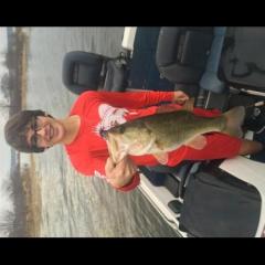
I'm going to be on La Nana in a couple weeks with the wife and two boys (11 & 8). Any pointers on where to start and what to look for would be much appreciated. With this crew, we'll only need to catch a few fish of any size to be a successful guide.
I'm trying to find an SD card for my Lowrance HDS that shows the contours of the lake. What's a good one? And is there somewhere local that I can get one?
You're killing me with that thread. I'm 47 pages into it and bound to get fired at any moment. And that thread is exactly why I'm looking for a map. I know I can buy the hook and line map, but I was looking for something I could download. Even if it's not as detailed.
Where can I find an online map that shows all the areas/coves/creeks of Toledo Bend? I see references to different areas on here all the time, but have no idea where they actually are.
We have placed cookies on your device to help make this website better. You can adjust your cookie settings, otherwise we'll assume you're okay to continue.