Super User jbsoonerfan Posted February 9, 2020 Super User Posted February 9, 2020 This might have been discussed, couldn't find it if it has. Could be a dumb idea, I don't know but I'm just thinking. Could a guy buy a tablet and mount it some kind of way (RAM mount) to the dash and use it for viewing lake maps while on the water. I have the Navionics app and I was thinking I could buy a tablet and use it for viewing a map on a larger scale than my Helix 8. This would also allow me to view SI and Sonar on my Helix while having the map on a separate (Larger) screen. Like I said, might be a dumb idea, maybe the kids are just driving me crazy, I don't even know at this point. LOL 1 Quote
Super User Tennessee Boy Posted February 9, 2020 Super User Posted February 9, 2020 It must be a dumb idea because I do it. The Humminbird FishSmart app has the same Lakemaster maps as my Humminbird FFs. You do have to buy them though. My iPad has a much better screen than any FF on the market. I typically don't taking the iPad when it's raining or very hot. They are not designed for harsh environments. I got a new iPad recently so I'll probably take the old one out more often now. RAM makes mounts for them but I don't have one yet. 1 Quote
Super User jbsoonerfan Posted February 9, 2020 Author Super User Posted February 9, 2020 I have the FishSmart app as well, but I like the Navionics because it has better maps IMHO. 1 Quote
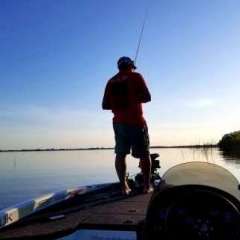
Super User MN Fisher Posted February 9, 2020 Super User Posted February 9, 2020 I use the I-Boating app on my Galaxy. Have that on a mount directly above my Hook-2 (mounting position of Hook-2 and tablet has changed since this pic). I get 1' contours and GPS with tracking and waypoints. This is a recording of my July 31, 2019 trip when I caught my best-of-year. Quote
Logan S Posted February 9, 2020 Posted February 9, 2020 I've thought about this several times - But haven't yet because of concerns over how waterproof I can make it and the power situation. I know there are water proof cases and I can run a power cord to it like anything else but I just can't see it standing up to the abuse that a regular graph does. I know several pros do this because I've seen them mounted in their boats, but they don't talk about it a ton. Quote
ohboyitsrobby Posted February 9, 2020 Posted February 9, 2020 I've velcro'd my tab e with navionics to my dash a few times before Garmin had maps to a few lakes I fish. Wouldn't do it in the rain or real rough water but it did what was asked when needed Quote
Bassun Posted October 8, 2020 Posted October 8, 2020 I use my Galaxy S9+ as a chart using C-Map all the time. Works just great, although the screen is a little small, lol. The concern I have with a tablet is they are not very bright and hard to see in direct sun. The sammy is fine unless I happen to get a direct reflection of the sun. And it's already waterproof, so no worries there. There are waterproof cases for tablets, so that can be addressed safely. I ram mounted my phone on top of the console. I can record video, and take photos with it where it is mounted with no issues. Turn on the "voice" control for pictures and you can stand back and just say "Shoot" and it will take the pic. Couldn't be easier. 1 Quote


Recommended Posts
Join the conversation
You can post now and register later. If you have an account, sign in now to post with your account.